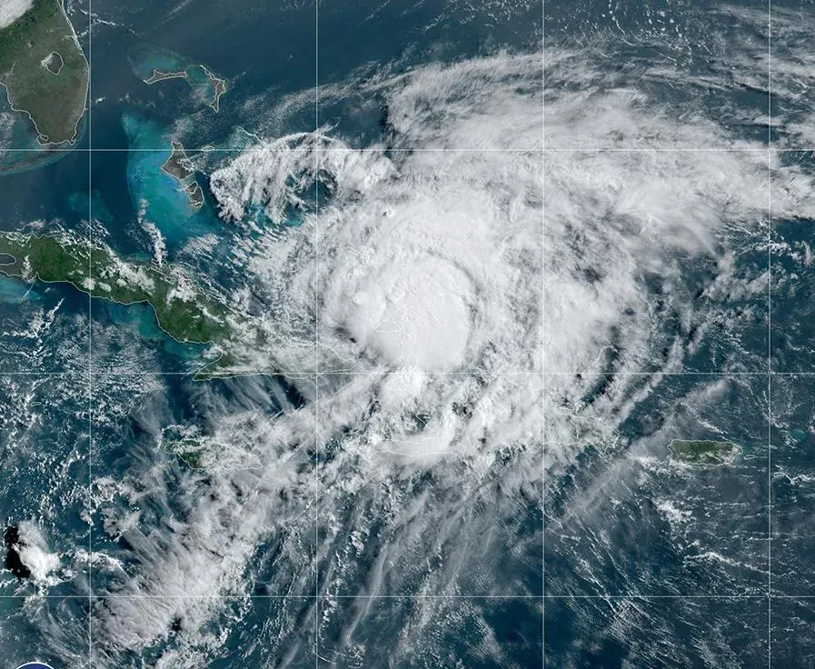
The system became the first hurricane of the Atlantic season and threatens to bring heavy rainfall, flooding, and storm surges to the Gulf Coast. U.S. authorities are stepping up preparations ahead of its arrival.
Hurricane Isaías, the first hurricane of the 2026 Atlantic season, continues to strengthen as it churns across the Gulf of Mexico toward the southern coast of the United States.
According to the latest advisory from the U.S. National Hurricane Center (NHC), issued Thursday, October 8, Isaías was packing maximum sustained winds of around 130 km/h (80 mph), with higher gusts, and was moving east-northeast. The system was centered approximately 680 kilometers (420 miles) south-southwest of the mouth of the Mississippi River.
An exceptionally late hurricane
The emergence of Isaías marks an unusual milestone for the Atlantic hurricane season. The year's first hurricane developed right at the threshold of a historical record: in 1905, the season's first hurricane formed on October 8.
The 2026 season had recorded relatively low activity across the Atlantic basin, a trend meteorologists link to a strong El Niño event, which typically hampers the formation and organization of tropical cyclones in the region. However, prevailing atmospheric and oceanic conditions in the Gulf of Mexico fueled rapid intensification.
Landfall expected between Friday and Saturday
NHC forecasts project that Isaías will continue heading northward and could make landfall along the northern Gulf Coast late Friday or in the early hours of Saturday.
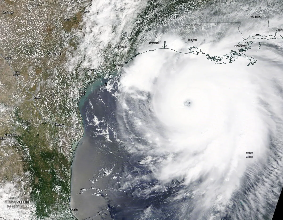
Forecast models indicate the storm could gain further strength before reaching the U.S. mainland. Official projections warn that winds could surpass 175 km/h (110 mph), significantly heightening the potential for widespread damage.
The watch area spans several stretches of the Gulf Coast, where emergency management officials warn of hazardous conditions driven by damaging winds, heavy rainfall, and dangerous storm surge.
Torrential rain and flooding
The primary threat extends well beyond destructive winds. The NHC estimates that Isaías could dump between 7 and 18 centimeters (3 to 7 inches) of rain, with locally higher totals, across parts of the central Gulf Coast.
Precipitation could spread deeper into the southeastern United States, impacting areas across Tennessee and the Carolinas. Heavy runoff could trigger flash and urban flooding, particularly in areas experiencing sustained downpours over several hours. Forecasters also expressed concern over storm surge, which could dangerously elevate sea levels and inundate coastal communities.
Preparations and economic fallout
Isaías's approach has already started to impact regional commerce. Offshore oil and gas operations in the Gulf of Mexico have been partially suspended as a precaution, and personnel have been evacuated from several offshore platforms. Disruptions to energy production could trigger volatility in fuel markets should the storm cause prolonged infrastructure outages or damage.
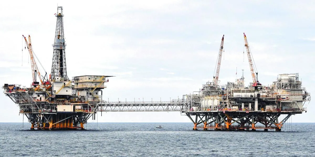
Several coastal municipalities have also canceled public gatherings and scheduled weekend events due to the impending storm.
Emergency officials continue to monitor Isaías closely and urge residents across vulnerable areas to rush preparations to completion before adverse weather begins.